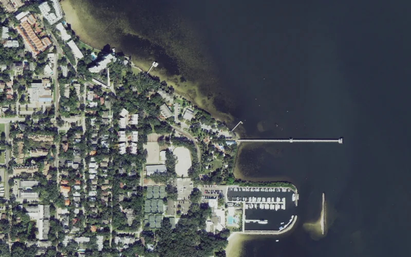
This edition follows the named Ballast Point record in Tampa’s official neighborhood map. Association, property, historic, school and administrative boundaries can differ; use an address-specific source for the question involved.
Get to know Ballast Point
Ballast Point occupies the Hillsborough Bay side of South Tampa, north of MacDill Air Force Base. The city’s neighborhood map stretches from Gandy Boulevard toward the base and includes inland streets as well as the waterfront. That makes the park a useful introduction, but not a substitute for understanding the residential area around it. An outing here can combine bay views, neighborhood history and an ordinary errand on MacDill Avenue. Start with the actual destination and its access arrangements rather than treating every waterfront facility as part of the public park.
Begin with Ballast Point Park at 5300 Interbay Boulevard. Read the current closure notice before leaving, choose a manageable time in the grounds and reserve a separate stop for food or shopping. Do not make walking the fishing pier the essential part of the day.
Start with these local connections
- Jules Verne Park history
- Current pier and fitness-center notices
- Hillsborough Bay and inland connections
A trolley destination with a literary name
The city’s neighborhood history connects the park to Tampa’s early electric trolley system. In 1894, Mrs. Chester W. Chapin developed the terminal grounds as Jules Verne Park, a reference to the novelist who had chosen Tampa for his imaginary moon launch. The historical marker gives a waterfront visit a more particular story than a skyline photograph alone. Look for the park’s older landscape setting while remembering that present facilities have their own operating rules. Historic descriptions do not establish that an attraction is usable today.
Read the closure before the amenity list
The city continues to list the 600-foot fishing pier as closed for hurricane repairs. Plan an outing around the particular park facilities you intend to use rather than the pier’s older round-the-clock-access description. Joe Abrahams Fitness Center has its own city facility page; confirm its current hours and availability there before planning an indoor activity. The splash pad, picnic spaces and boat-ramp arrangements are separate subjects, so check the intended facility and any current signs before traveling.
The city publishes different seasonal splash-pad schedules, and weather or maintenance can interrupt them. A playground outing therefore needs a dry-land alternative. For boating, check the ramp, trailer-parking arrangement and any current restriction independently. Nearby docks, marina facilities and residential waterfronts should not be assumed to be public park access.
Put the inland streets into the plan
Interbay Boulevard, Bayshore Boulevard and MacDill Avenue answer different travel needs. Choose the entrance to your actual destination, then plan any crossing or return journey. Combining a park visit with a nearby business works best when you have checked its address, hours and parking first. A location described as South Tampa can be close to the neighborhood without being inside the city’s mapped Ballast Point area. Bayshore Beautiful, already covered separately, is another named neighborhood rather than an interchangeable label.
Turn a visit into a useful resident check
For a home search, use the complete property address in the district-linked school locator and verify the relevant school year. Open the city’s neighborhood-services guide for address-specific municipal and council information. Families considering a class or youth league should follow the city recreation catalog to the actual program, site and operator. A park visit does not reserve a sports place, and a neighborhood association does not assign schools. Keep each question with the organization responsible for it.
Neighborhood questions
Is the fishing pier currently a reliable walking destination?
The city page reviewed November 13 lists the pier as closed for hurricane repairs. Confirm any later reopening with the city before planning around it.
Is every nearby dock public?
No public-access conclusion follows from proximity to the park. Check the actual facility, entrance and operator.
Schools, civic contacts & everyday resources
Use your full street address for school and electoral questions. A city name, neighborhood label or nearby landmark does not establish the assignment for every home.
Official resource paths reviewed November 10, 2026. No household school or representative assignment is asserted here.
Find your bearings
Ballast Point Park is the orientation point on this map. The marker identifies one place; it does not draw the neighborhood, school zone or property boundary.
Public-facility orientation only; use signed entrances and current operating notices. This point is not a water-access, parking, neighborhood or school-boundary claim.
Show the orientation map
Open a larger map ↗ · Official location source ↗ · Map data © OpenStreetMap contributors
Local information reviewed 2026-11-13. Photograph date and rights are recorded separately.
Useful reading
Getting around Tampa Bay: plan the actual journey
Match your destination to the right transport system and check both directions before committing to a day out.
Choosing a Tampa Bay neighborhood: questions a listing cannot answer
Separate the place name from the address, then compare the everyday journeys and services that matter to you.
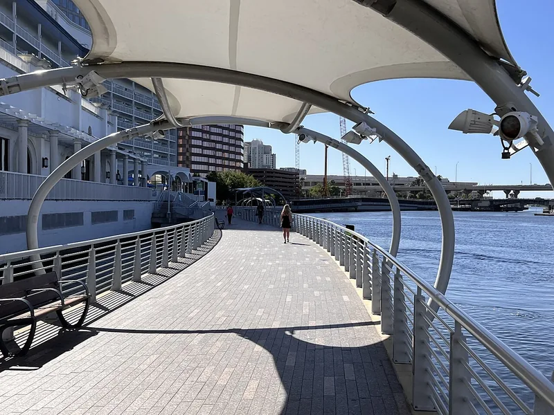
A better first day along Tampa’s Riverwalk
Choose a manageable stretch, connect the waterfront to nearby stops, and leave room for weather and the return trip.
Local sources & practical next steps
- City of Tampa — exact Ballast Point neighborhood record ↗
- City of Tampa — Ballast Point Park facility point ↗
- City of Tampa — Ballast Point ↗
- City of Tampa — Ballast Point Park ↗
- City of Tampa — Current park advisories ↗
- City of Tampa — Neighborhood services by address ↗
- City of Tampa — Joe Abrahams Fitness Center ↗
- Official local information ↗
- Find related places and mapped areas
- Explore Hillsborough event calendars
Use current city, county and operator information for an exact address, opening hours, service access and event details.